
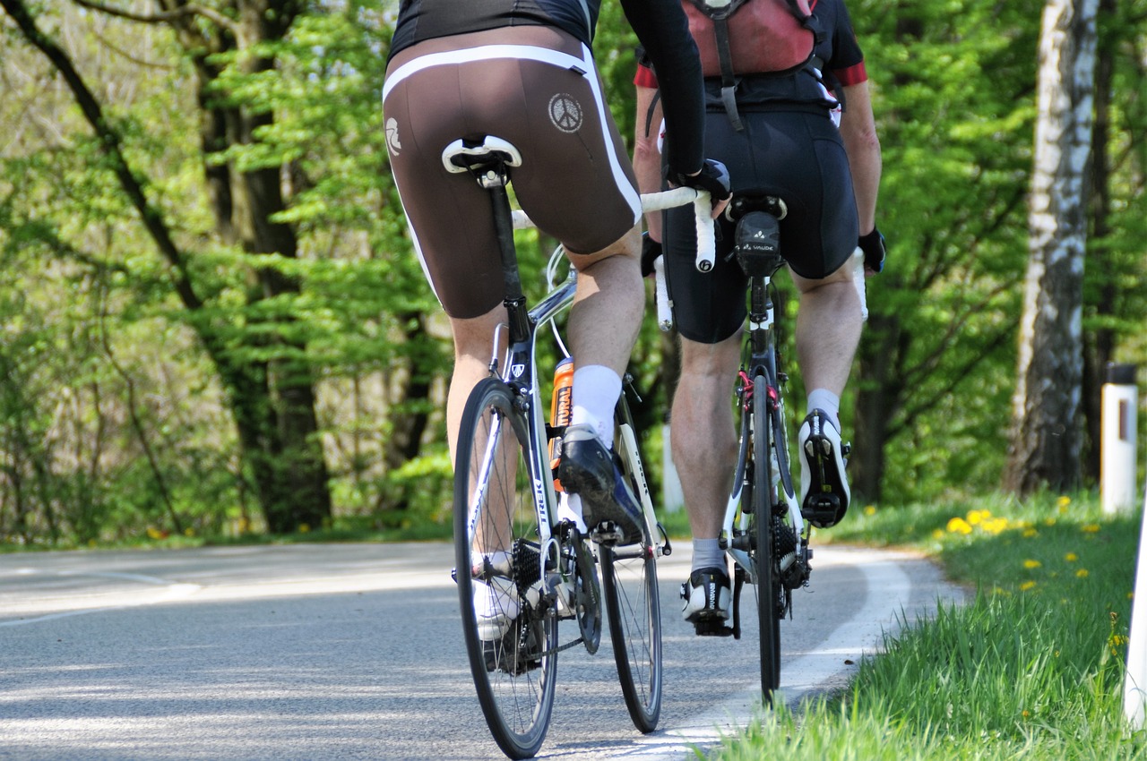
It’s rare for a city to get something for nothing, but that’s exactly what is happening in Norwood, thanks to the Wasson Way Bike Trail. From what I understand, the City of Norwood has contributed nothing to the Wasson Way project. Despite that, homeowners and businesses in South Norwood will almost certainly see a bump after the trail opens.
In anticipation of the opening (expected in November 2019), there has been increasing talk about adding bike lanes on Norwood streets. After all, we’re getting this great thing for free, so it makes sense to want to throw gasoline on that fire. Last night at the Ward 2 community meeting, the topic came up again, which made me wonder “where could bike lanes fit in South Norwood?”
Understanding the basics
How wide do bike lanes need to be?
Can we have them on one side of the street, but not the other?
These are questions that I don’t know the answer to. Thankfully, there are people are there who do. No need to reinvent the wheel (although maybe we should reinvent the wheel to make it more suitable for Norwood’s roads).
As far as bike lane width, there are slightly different guidelines depending on the type of road, but the simplest answer for our roads is that they need be four feet wide. We don’t have the “gutter pan” referenced below.
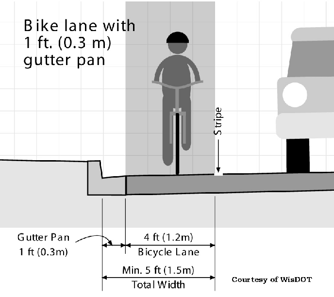
See, no gutter pan. Just curb, then road. ⬇️

So, one lane would take up four feet of the road.
The logical next question is whether or not we need bike lanes on both sides of the road. According to the Federal Highway Administration’s course on bicycle and pedestrian transportation “Bicycle lanes are always located on both sides of the road on two-way streets.”
In summary, if we wanted to add bike lanes, we would need to take up at last eight feet of road.
Where can’t bike lanes fit?
One of the things that makes Norwood great is its pre-World War II layout. Many Norwood homes were build before 1930 — a.k.a. before the mass adoption of cars — which means that the streets, homes and driveways weren’t built for today’s car culture. This is also why it’s so pleasant to walk around the interior neighborhoods of Norwood.
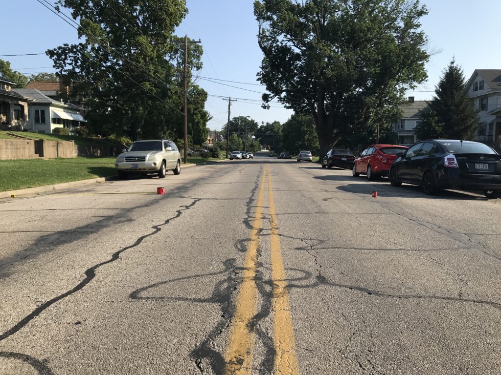
On the other hand, this creates a problem because the mass adoption of cars has required that many of us park on the streets, rather than in our narrow or nonexistent driveways.

The image above shows a familiar Norwood street. There are cars parked on both sides. People generally drive down the middle of the street. If a car approaches from the other direction, you pull over just enough so that they can pass. You know the type. These streets are 30 feet wide, highly-residential and would be very difficult to add a bike lane to.
Where could bike lanes fit?
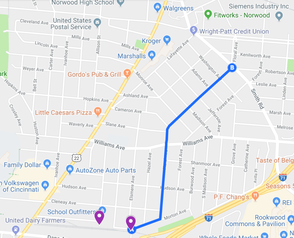
The following map shows, in blue, all the stretches of road in South Norwood that are wider than 35 feet. In other words, these are all the roads where it might be possible to add eight feet worth of bike lanes and still have enough room for cars.

The purple markers at the bottom indicate the access points to Wasson Way. Feel free to explore the interactive map where you can toggle on/off different roads.
The first thing I notice when looking at this map is that there’s really only one wide-enough road that connects to a Wasson Way entry point, which is Floral. See below.
That Floral is one of the widest roads in South Norwood makes sense to me. It’s a main artery of the neighborhood and is also known for having some of the nicest homes in the area.
Coincidentally — or not — I’ve also heard a number of Floral residents complain that people drive too fast on their street. This shouldn’t come as any surprise, as there is a direct correlation between lane width and car speed. Wider lanes = more speed. Narrower lanes = less speed. So, not only is Floral wide enough to accommodate bike lanes, it would also help residents achieve their desired outcome of slowing down cars.
To see what bike lanes on Floral could look like, I did a little experiment. The road is 40 feet wide, which means that each half of the road could fit a four-foot bike lane, an eight-foot parking lane and an eight-foot driving lane. It’s worth noting that the average car is about 6.5 feet wide.
In the following image, the red coffee cans represent how far out the parking lane would come, if you added a bike lane right next to the curbs.
Let me say this again: Even with four-foot bike lanes added on each side of Floral, the usable car space of 32 feet would still be wider than the “standard” roads in South Norwood (Elsmere, Hudson, S. Madison, etc.).
Walking this thought experiment a step further, I think the second-most useful route is the one that runs down Williams and then turns up Forest.
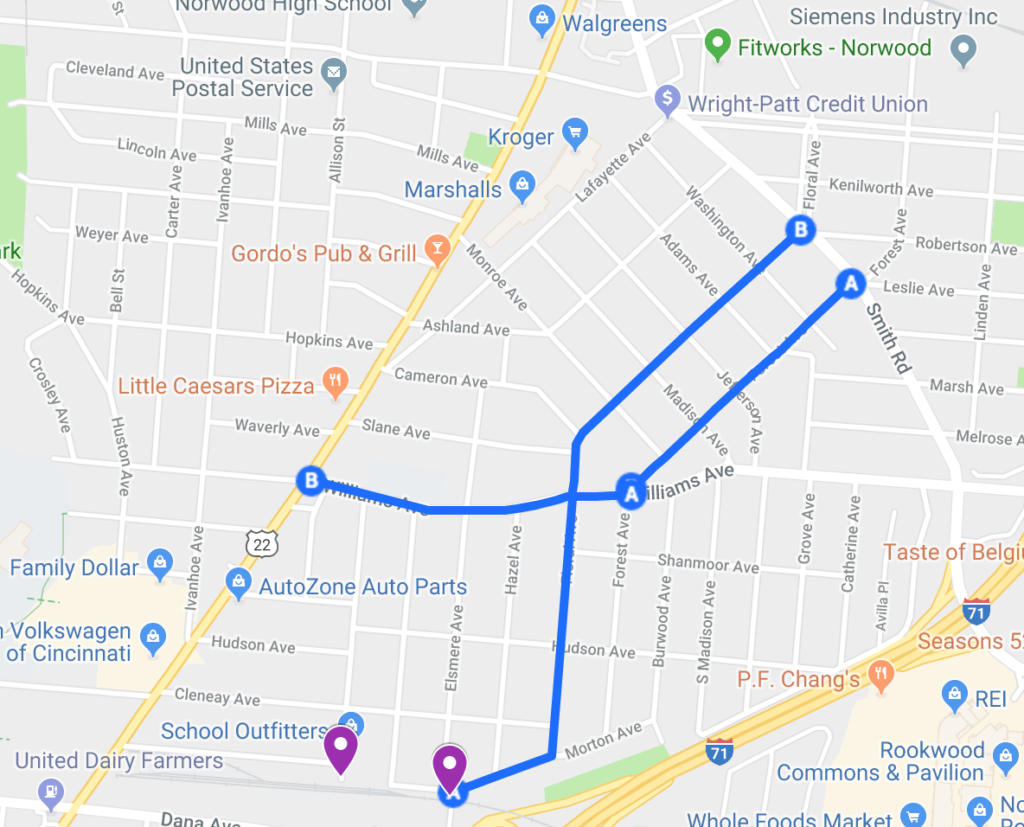
The widest interior road in this part of Norwood is the stretch of Forest that runs between Williams and Smith. I measured it to be 47 feet wide. The next widest roads, like Floral, are 40 feet wide. Since this stretch is parallel to — and somewhat redundant with — the north half of floral, it could make sense to use Forest instead of Floral.
Another thing I love about a hypothetical Williams/Forest stretch of bike lane is that it would connect Williams Ave elementary with Sharpsburg Elementary, meaning slower traffic and safer biking routes for our school children.
What happens next?
My good friend, an entrepreneurship professor, likes to ask “Do people want this, or do you just want to do it?” That is the big question here. Yes, it seems like a good idea, and other cities are doing it, but is there demand?
I personally ride my bike a lot, but I don’t see many others who do. Is that because the roads are too unsafe for cyclists? Or because there aren’t many bike riders in Norwood?
But if Wasson Way is going to bring bike riders TO Norwood, wouldn’t it make sense to empower them to navigate our city as safely as possible?
Ultimately, here’s what I’d like to propose: This fall, immediately following the Wasson Way opening, we plan a “two day test ride.” Meaning, over a weekend, we would draw chalk lines where bike lanes could be, communicate the occasion to residents, people would be asked to park five feet closer to the center of the road — the same type of deal as when there’s any kind of construction project — and then we see what happens over the next 48 hours.
Maybe people use it, and maybe they don’t. Maybe people park where they’re asked to, and maybe they don’t. But ultimately, it would bring the guessing game to an end. We wouldn’t have to hypothesize about the viability of bike lanes. We could observe it. And then, however the experiment goes, we would have new information that we could use to move Norwood forward.
—–
Move Norwood Forward aims to shed light on the people, businesses and happenings of Norwood, Ohio that are bettering the city. If you know of a person who should be featured on an episode, nominate them here.